Review, Revise, Renew
email: tim@tgomaps.com telephone: 07951 744312
TGO MAPS PROJECTS
Cornwall custom maps
The following map examples were created using Lorienne software to stylise and output the mapping and produce print ready PDF files for the client.


This project was produced on behalf of Lovell Johns Limited.
Poole seafront wayfinding

This project required the generation of new mapping using OS data for the Poole seafront area. This mapping was re-orientated to create 5 new wayfinding totems from Sandbanks to Branksome Dene.


This project was produced on behalf of BCP Council.
Cicerone guidebook mapping
My contribution to this new Cicerone guidebook was to create the route maps and overlay the GPX routes required for the 30 walks detailed in this book. The files were created and supplied in Adobe Illustrator format.


My contribution to this new Cicerone guidebook was to create the route maps and overlay the routes required for the 30 walks detailed in this book. The files were created and supplied in Adobe Illustrator format.

These projects were produced on behalf of Cicerone.
Poole Bay Beach Management


Working with the Flood and Coastal team at BCP council, these maps were created to illustrate the coast protection works along the Bournemouth and Poole seafronts.
These maps will be used for public notices, website notifications and site signage.


This project was produced on behalf of the Flood and Coastal Erosion Risk Management Team.
Christchurch Bay and Harbour Management


Working with the Flood and Coastal team at BCP council, these maps were created to illustrate the coast protection works along the Christchurch seafronts.
These maps will be used for public notices, website notifications and site signage.


This project was produced on behalf of the Flood and Coastal Erosion Risk Management Team.
National Trails poster - England and Wales

For this National Trails publication I created the vector base mapping including hill-shading. The National Trail routes were read in from GPX files and coloured according to the brief.

This poster can be found at the Trails shop website.

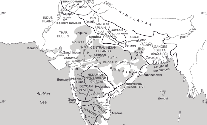
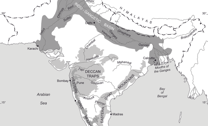
Historical maps of India
This collection of maps was designed using OpenData to feature in two book projects for the London School of Economics.
"I enjoyed working with you, your work is top quality... will recommend TGO Maps to others"
Tirthankar Roy, Professor of Economic History
Scotland's Great Trails poster

For this Scotland Trails publication I created the vector base mapping including hill-shading. The Great Trail routes were read in from GPX files and coloured according to the brief.

This poster can be found at the Trails shop website.

Delivery Map posters

These delivery map posters can be supplied as a laminated sheet of approximately 100cm x 143cm. Includes delivery area boundary, concentric distance circles from the site location and postal information including detailed postcode sectors.
For custom poster enquires please contact me at TGO Maps.


